Georeferencing Planes Using Claude Code
How I tried to correctly map planes in a breaking news situation with Claude – and failed.
So, about two weeks ago, right after the start of the Iran war, I tried to map the situation of the airspace in the Middle-East. What I had, was a Flightradar-screenshot from a week before the war.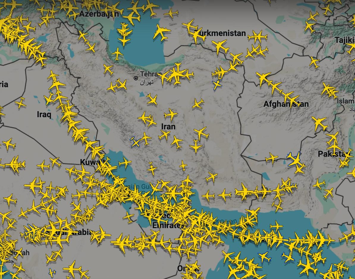
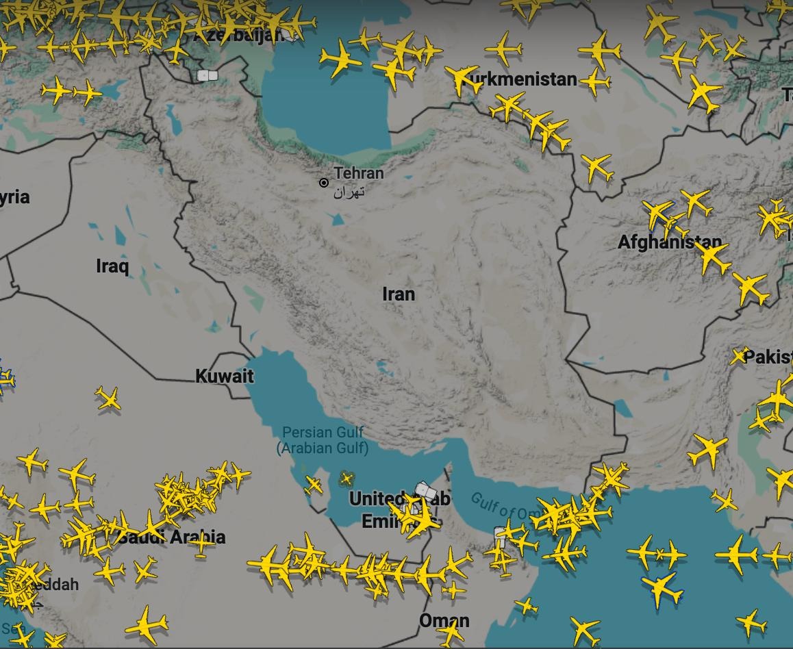
And one right after the war started.
To map these planes is not that difficult. There are very good videos that show you how to do it in QGIS. But of course, it is incredibly cumbersome to map some hundred odd planes using a hands-on approach.
So I describe to Claude the task, linked to the video and had the two images as context in a folder. I explained how it should use the borders shown to georeference the images first. And then determine the position of the planes and spit them out as a GeoJSON.
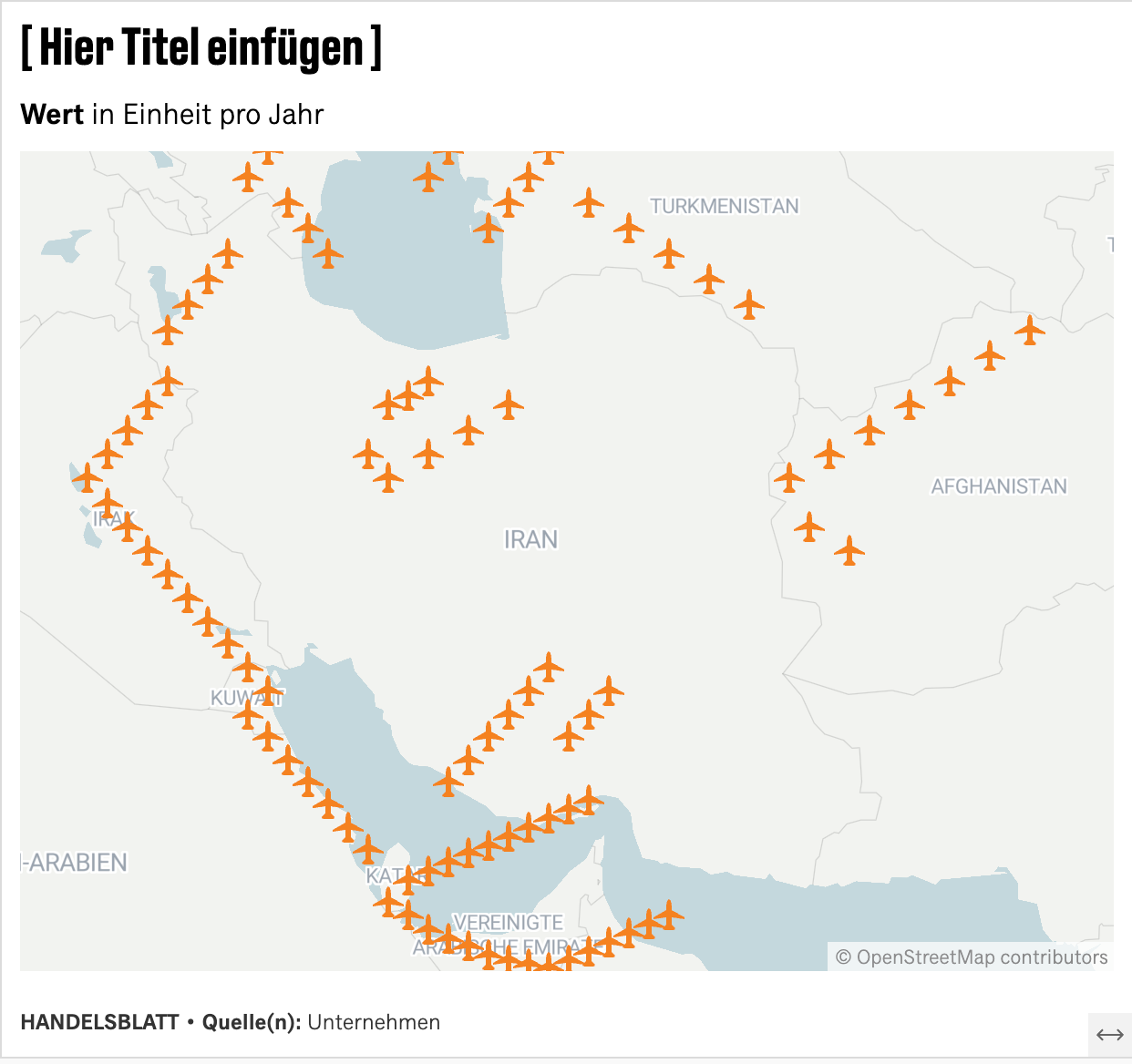
Well, that did not quite work out. As much as the general idea is correct that the Iranian airspace was not as busy as the U.A.E. airspace even before the war – these patterns are not anyhow close to reality.
So, in breaking news situations like this, I will for now still refrain from handing over a task like this. But does anyone know some better approaches? Are there more specialised AIs for geocoders?
Comments 0
No comments yet — be the first.